
Current projects
| THE SARCA RIVER PROJECT | |
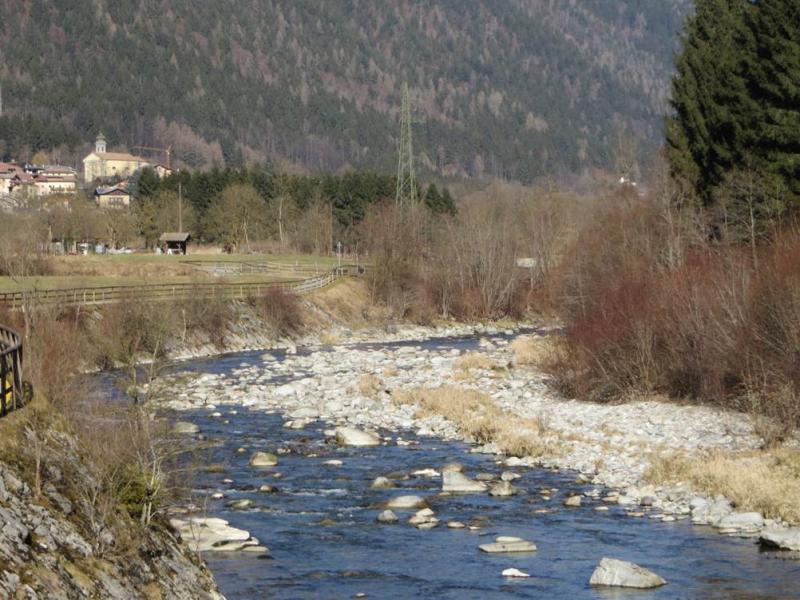 |
Most rivers in the European Alps have strongly regulated flow regime and channel morphology. Despite the strong hydromorphological regulations, these streams often represents valuable environmental systems that support biotic communities, offer recreational opportunities and provisioning ecosystem services. The Sarca River is a mountain-piedmont gravel bed river flowing from the Adamello glaciers down to the Garda Lake and is witnessing an increased interest from a variety of local stakeholders, that have formalized a coordinated network of natural protected areas in the catchment. The Sarca River project aims at developing river restoration guidelines for the Sarca River. The main activities foreseen within this applied research project relate to the study of river morpho-dynamics and of fish habitat availability, through a combination of field activities, mathematical modelling and analysis of aerial images. |
| ETSCH-2000 | |
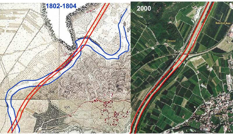
| Most large rivers in Italy and Europe have been strongly altered by human activities since centuries. In the Italian Alps, in particular, existing studies on the historical evolution of large river have focused on river reaches with a predominant braided morphology. Moreover, at the European level, investigations addressing large timescales in reaches characterized by original meandering (single-thread or anastomosed) morphologies are very few. The goal of the ETSCH-2000 project is to reconstruct the morphological adjustments of the Adige / Etsch River between Meran (BZ) and Borghetto (TN) over the last 2000 years, and to relate it with the history of relevant direct (e.g. channel rectification) and indirect (e.g. variation in hydrological and sediment regimes) pressures, anthropic and climatic alike. ETSCH-2000 proposes an innovative interdisciplinary approach that integrates geo-historical investigations, geomorphological analysis and mathematical modeling aimed at providing a unique morpho-historical reconstruction of a large river system at large spatial (150 km) and time (2000 yr) scales. The geohistorical and modeling results will provide a modern view on the concept of reference conditions for such a highly modified river system and will be extended to other similar European rivers in the perspective of developing sustainable river management strategies, taking into account also the most probable future climate and land management scenarios. |
|
 ghg
ghg